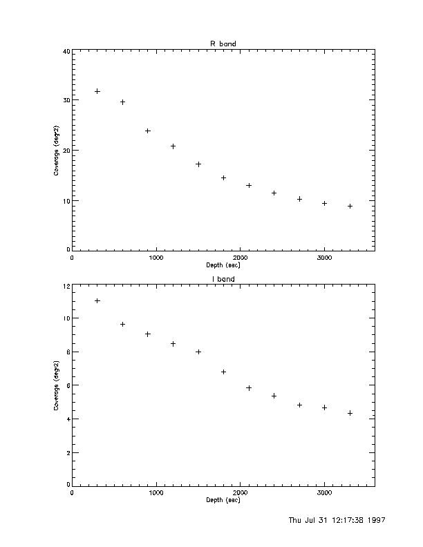
The following graphs plot the area of sky (in degrees^2) we have covered in our database as a function of the depth to which we have it covered. The plot on top is of coverage vs. total depth, that is the amount of sky covered to a total depth of 300s, 600s, etc. The plot on bottom is of coverage vs. the maximum depth for any one image.
These plots were made using the procedures depthchart.pro and plotdepth.pro (both are documented in $dh/idlpro/).
Click on either image to download the postscript file.
Coverage vs. total depth
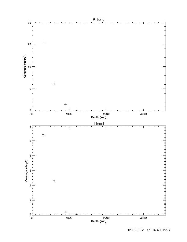
Coverage vs. maximum depth